Natural Resources Data Management System (NRDMS) Helping Create a GIS Ecosystem
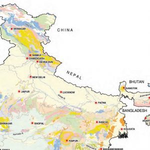
<p>The Natural Resources Data Management System (NRDMS) is an initiative of Department of Science and Technology of Government of India, conceived to help Policy makers and planners to formulate developmental strategy.</p>...

.png )
.jpg )